2005年 アドリア海沿岸と中欧の旅 フォト ギャラリー 1
Croatia (クロアチア)
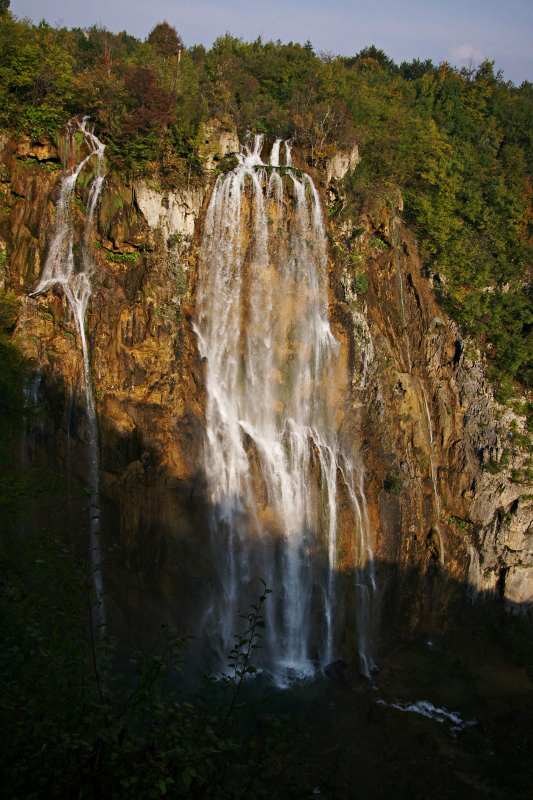
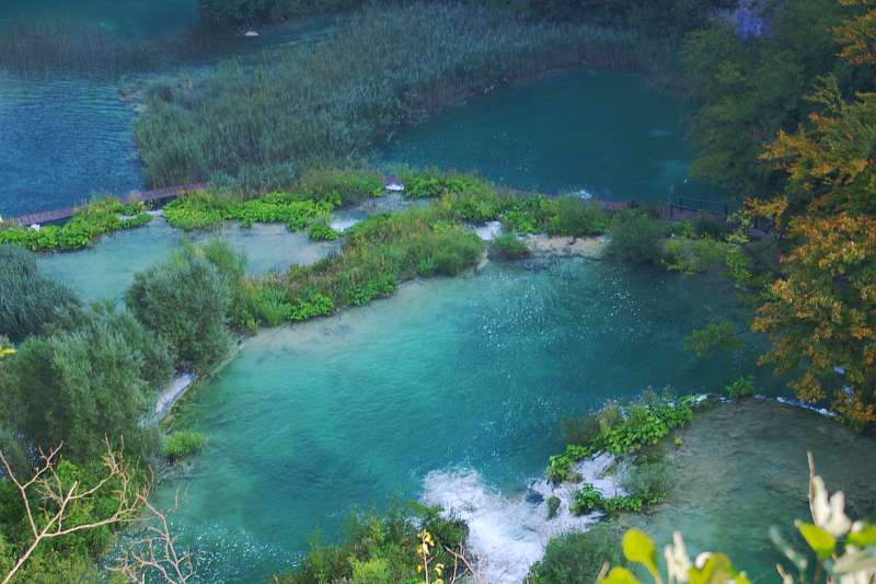
Nacionalni park Plitvička jezera (プリトヴィツェ湖群国立公園)
コバルトブルーの湖とたくさんの滝が、6kmくらいの範囲に広がっています。
Velike Kaskade (Cascade Falls)
Veliki Slap (Veliki Falls), approx. height 70m, biggest fall in this area
ヴェリキ滝(落差70m)、この辺りで最大の滝
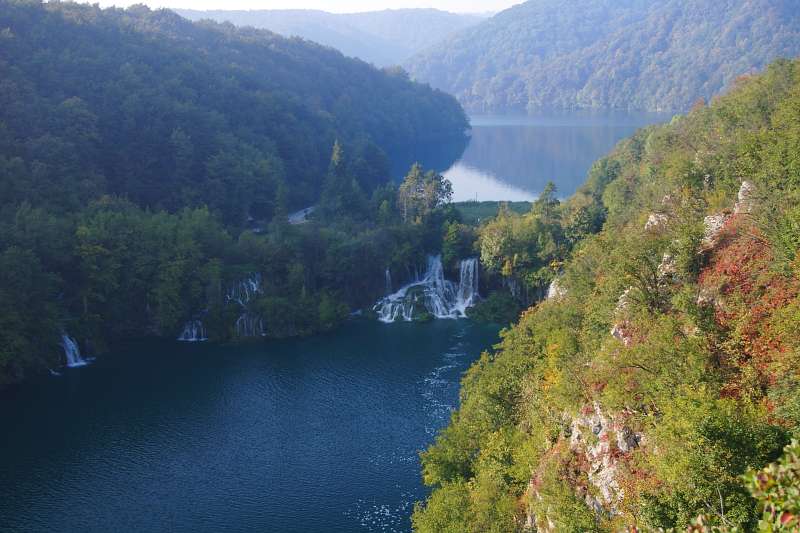
Milanovački Slapovi
Zadar (ザダル)
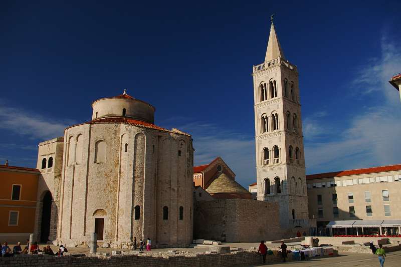
Church of St. Donat (left) and Cathedral of St.Anastasia (right)
聖ドナト教会と聖ストシャ大聖堂
Trogir (トロギル)
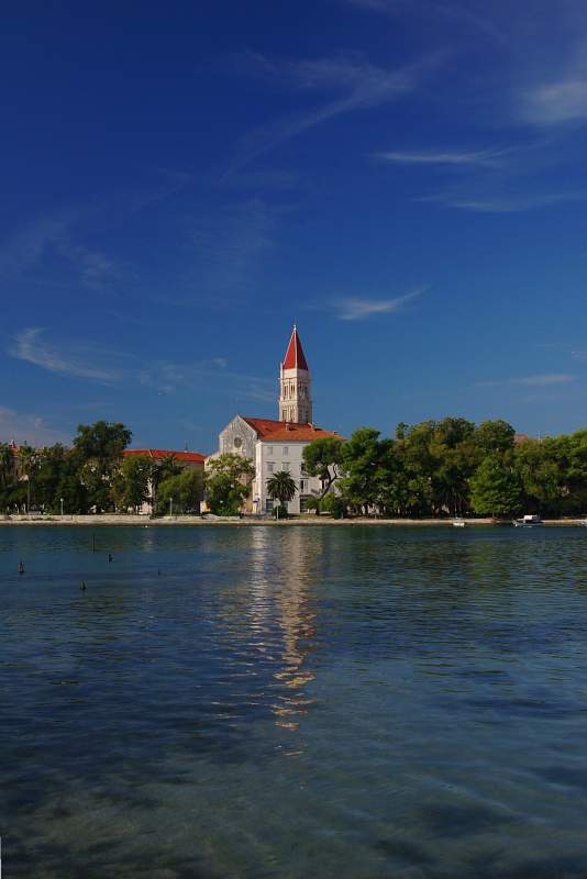
Tower of Cathedral of St. Lovro, fortified island of Trogir
トロギル要塞島、聖ロヴロ大聖堂の塔
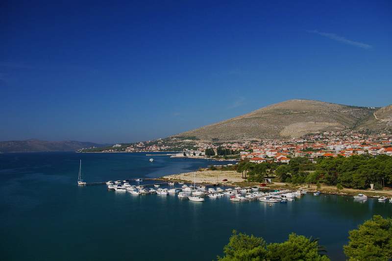
Dalmatian coast view, Splitski Kanal
ダルマチアの海岸線(スプリト海峡)の眺め
Split (スプリト)
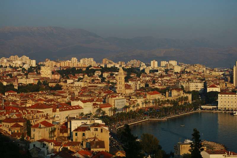
Old Town (Grad), view from Marjan Hill
マラヤン丘から見下ろした旧市街(ディオクレティアヌス宮殿)
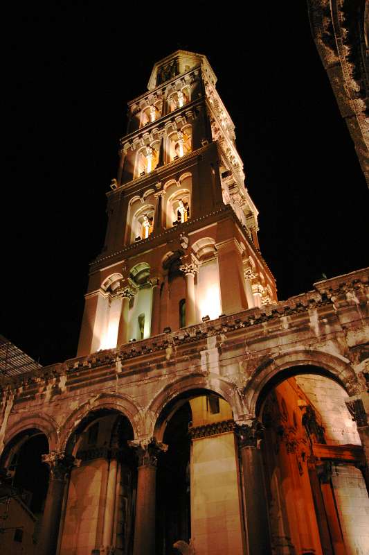
Cathedral of St. Domnius
大聖堂
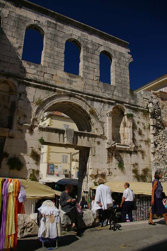
Silver Gate (East Gate of Grad)
銀の門(ディオクレティアヌス宮殿の東門)
Solin (ソリン:古代ローマ属州 サロナ)
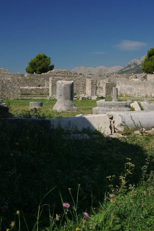
The ruin of Roman Salona
サロナ遺跡
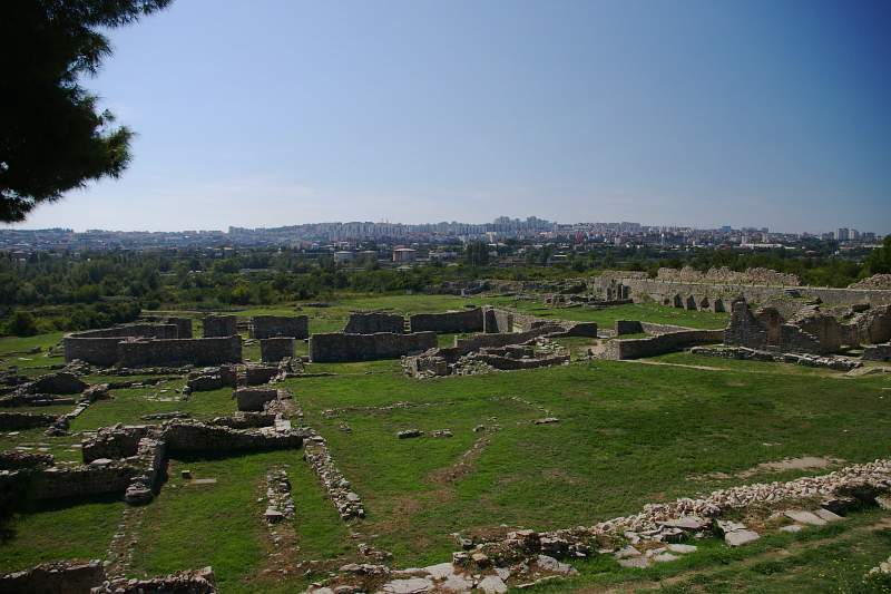
The ruin of Roman Salona with Nova Split hill for a background
スプリト新市街の丘をバックにした、サロナ遺跡
Dubrovnik (ドゥブロヴニク)
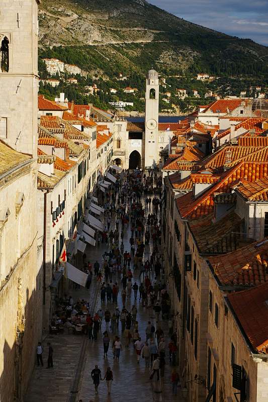
Placa (old town main boulevard)
プラツァ通り (旧市街の大通り)
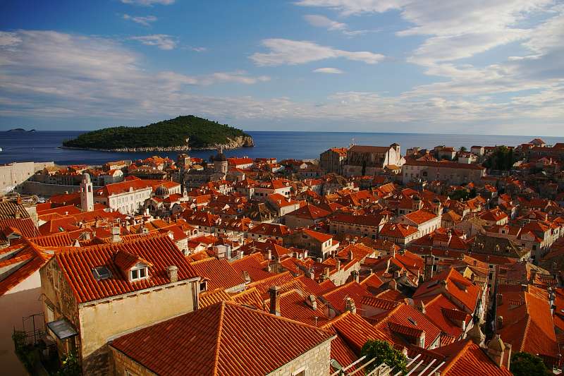
Old town, view from nothern city wall
城壁の北側から見た、旧市街
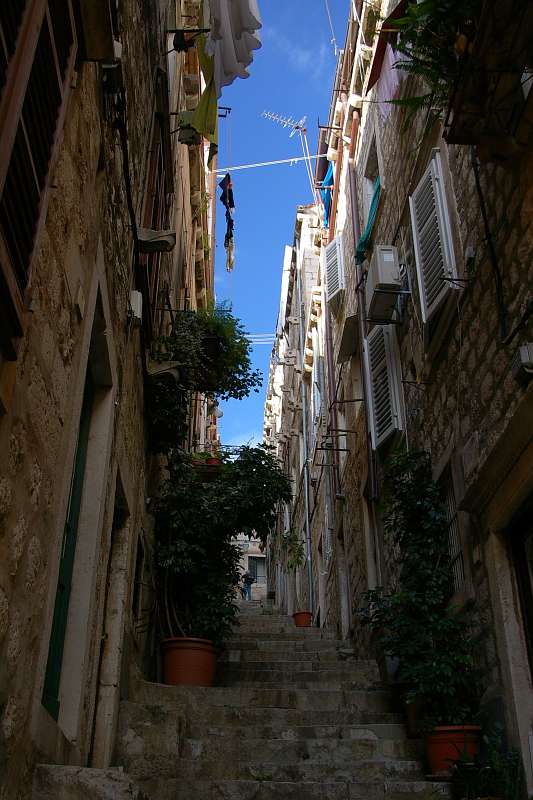
narrow and steep path, inside old town
旧市街の中は、このような狭くて急な路地
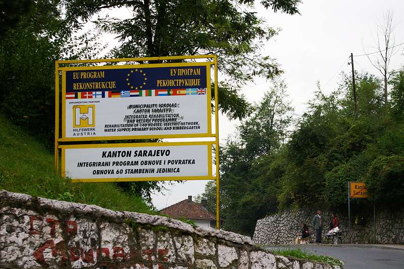
Bosnia and Herzegovina (ボスニア・ヘルツェゴビナ)
Doljani, Čapljina (ドリャニ)
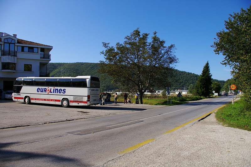
Metkovic (HR) - Doljani (BiH) boarder is behind "40km/h sign"
メトコビッチ(クロアチア)とドリャニ(ボスニア・ヘルツェゴビナ)の国境、"40km/h"標識の向こうにある
Mostar (モスタル)
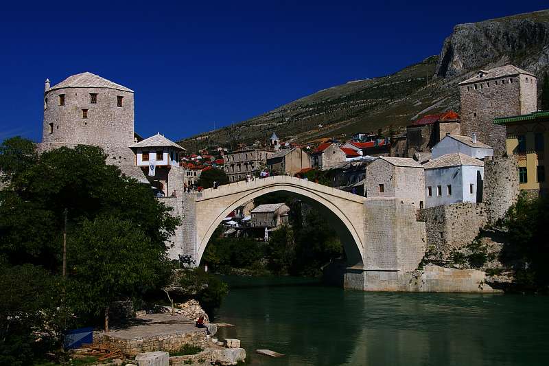
Stari Most (Old Bridge), rebuilt on 2004, at Islamic Territory BiH
橋(旧橋)、2004年に再建されたもの、イスラム区域
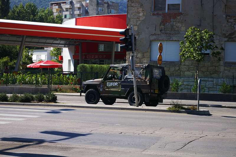
EUFOR patrol on front line (Bulevar Hrvatskih Branitelja)
EU軍が停戦ラインをパトロール (クロアチア・ブラニテリヤ大通り)
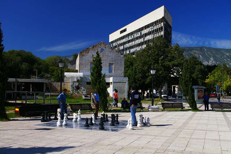
Playing chess at Španski Trg with completely destroyed building in background, at Croatian Territory BiH
廃墟となったビルとチェスをする人たち、シュパンスキ広場、クロアチア(キリスト教)区域
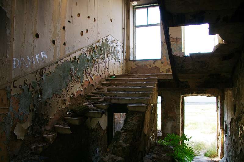
Playing chess at Španski Trg with completely destroyed building in many buildings are still abandoned, I hear there is still dangerous of land mine
たくさんのビルが今でも廃墟のまま放置されている。これらの周辺は現在でも地雷の危険性があるという
Sarajevo (サラエヴォ)
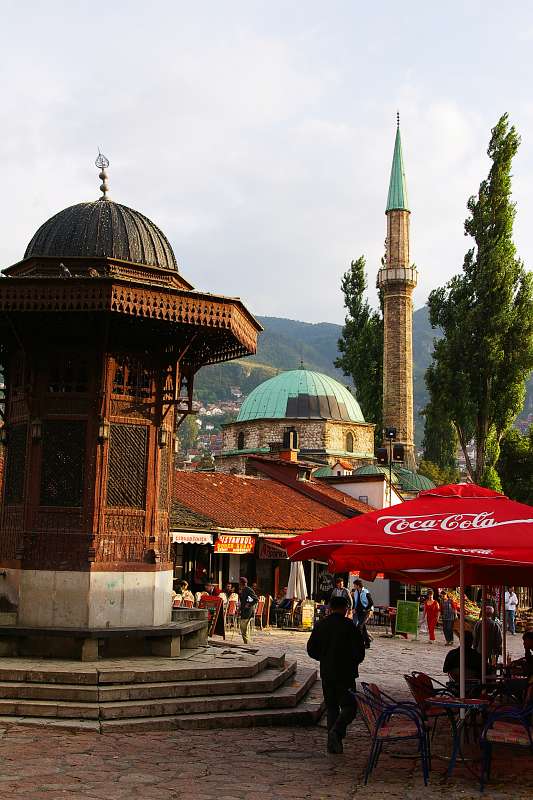
Playing chess at Španski Trg with completely destroyed building in many Sebilij, in Baščaršija (old Turkish quarter)
バシチァルシァのセビリ (旧トルコ区域)
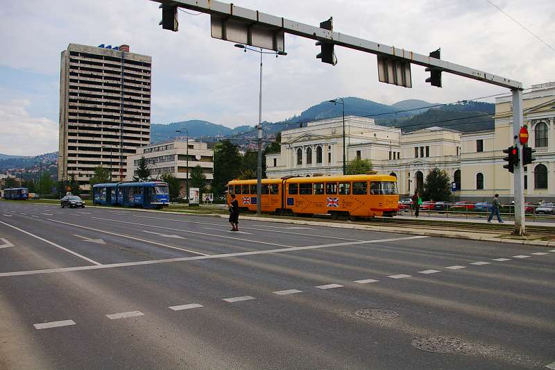
Zmaja od Bosne is called "sniper's alley"
スナイパー通りと呼ばれたところ
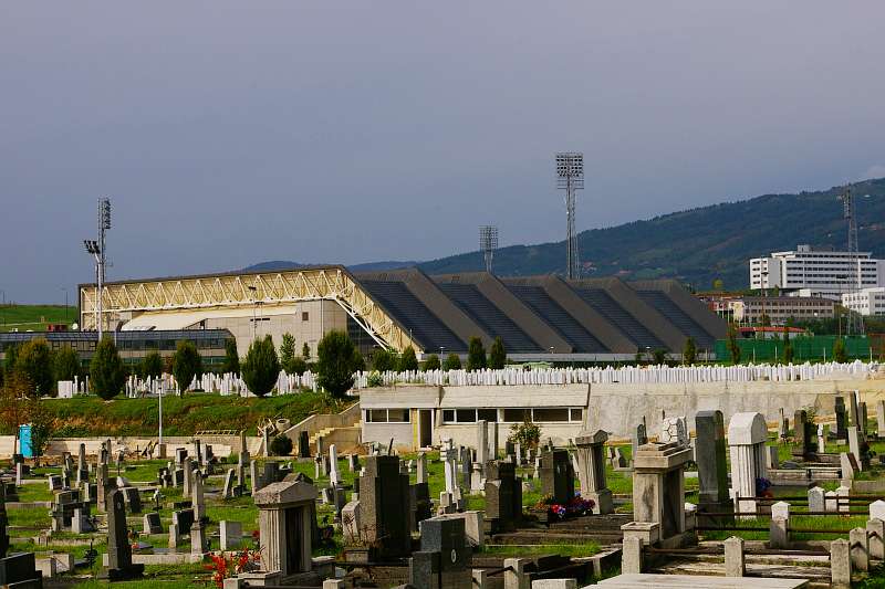
Koševo Stadion (Olympic Stadium) is surrounded by cemetery
コシェヴォ競技場(オリンピック競技場)は、墓地に囲まれている
Република Српска (スルプスカ共和国)
Ново Сарајево (ノヴォ・サラエヴォ)
boarder of Kanton Sarajevo (BiH) and Srpsko Sarajevo (Rep. Srpska) is at "yellow boarder plate"
ボスニア・ヘルツェゴビナ連邦とセルビア共和国の国境が、オレンジ色の看板のところを通っている
Ново Сарајево
ノヴォ・サラエヴォ
Austria (オーストリア)
Marchegg
This is International Train, from Wien to Bratislava, at the boarder station
ウィーンからブラチスラバに向かう国際列車が、国境駅に入ってきた
Slovakia (スロバキア)
Bratislava (ブラチスラヴァ)
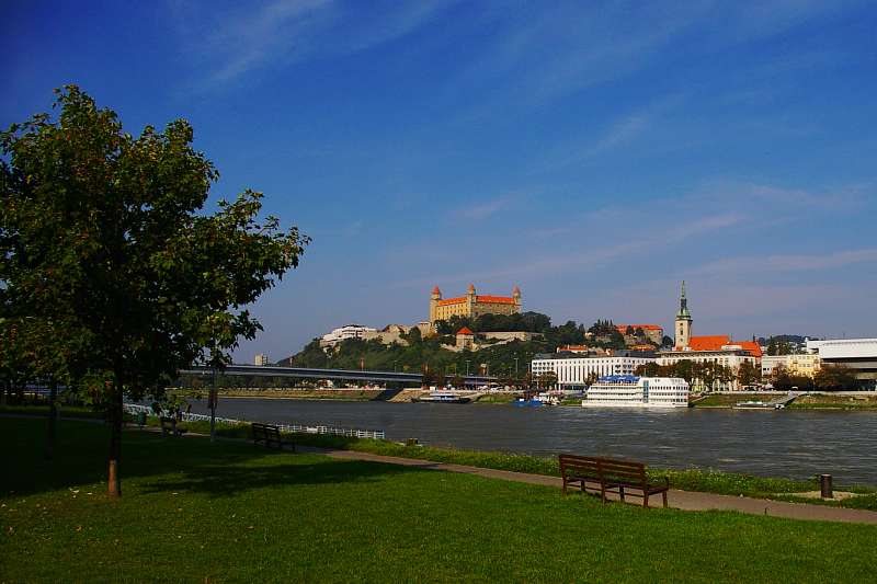
Bratislavsky Hrad (Castle Bratislava) beside Danube River
ドナウ川の畔に建つブラチスラバ城
In the old town
旧市街で
Hungary (ハンガリー)
Székesfehérvár (セーケシュフェヘールヴァール)
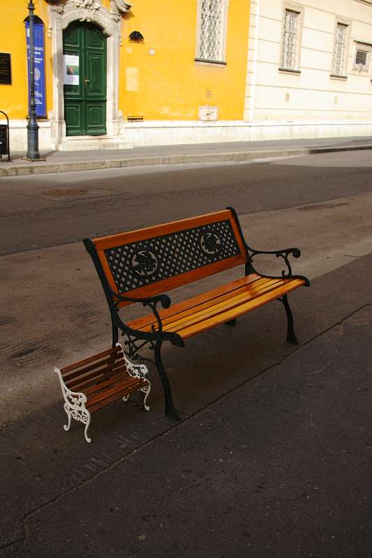
A pair of chair, on Fö utca
一組のベンチ
Budapest (ブダペスト)
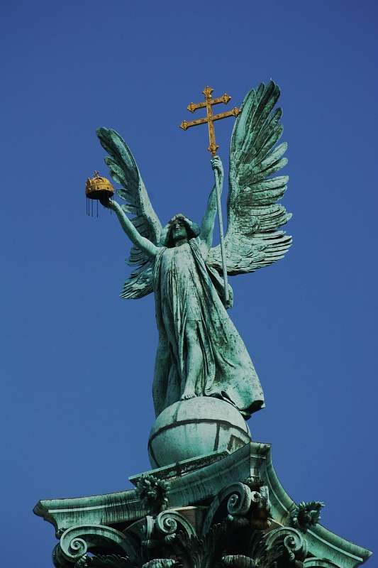
Statue of Gabriel, on the Millennium Monument
ミレニアム記念碑の聖天使ガブリエルの像
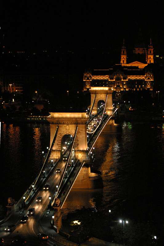
Lánchíd (Chain Bridge)
ランツィード (鎖橋)
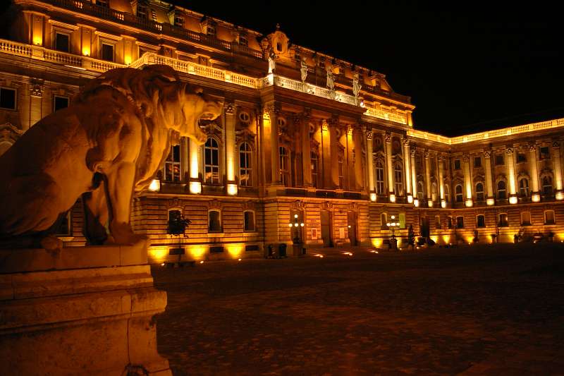
Royal Palace
王宮
Szentendre (センテンドレ)
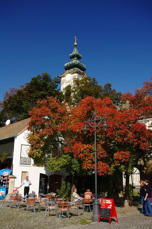
autumn tints
紅葉
England (イングランド)
Greenwich (グリニッジ)
標準的なGPSはWGS84座標系を使っているため、歴史的な"地球子午線"は完全にゼロ度線とはならない。
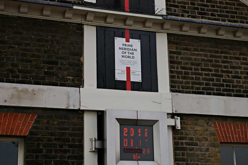
Prime Meridian line on the Royal Observatory of Greenwich
"地球子午線"の"線"、王立天文台
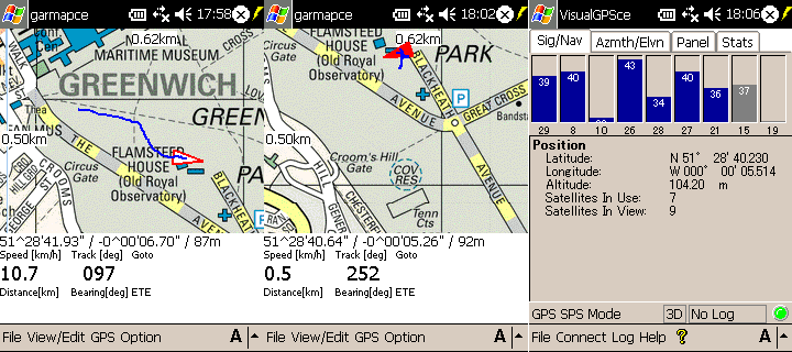
GPS track data : Walk to Observatory (left), at PRIME MERIDIAN (center and right)
GPSのログ : DLTの駅から天文台に向けて歩く (左)、"地球子午線"に到達 (中央・右)
"地球子午線"は、WGS84 では 0 度 0 分 5 秒 位となっている。
WGS84の論理的な子午線は、GPS画面では天文台右側の縦線である (約100mのずれ)。GB1936 という座標系を使えば、"赤い線"がぴったりと0度となる